



Surveying a sprawling map of the northern San Juans last week, Mike Smith was deep in a geometry of fire.
Fingers tracing fire lines and ridges, Smith – the current incident commander over Gold Mountain Fire operations – said firefighters were working to draw a “big box” around the blaze in its third week of burning.
That box – a network of fire lines cleared of fuels, controlled burns and natural buffers – is an immense lasso carved around the Cimarrons, gradually tightening to prevent the fire’s further spread.
“We’re hoping to be able to shrink it in a couple places. And there’s some other places that we’re probably going to have to put some fire on the ground because that’s the only choice,” he told the Plaindealer.
Smith and his crew, Rocky Mountain Complex Incident Management Team 2, formally assumed command of the firefighting effort at 6 a.m. on July 14, taking the reins from Team 3, which led fire operations beginning in its first few days. A self-described “twice-failed retiree” from fire management who lives in Jefferson County, Smith said he was walking into one of his first meetings before assuming command of the fire when he got the news.
“We were literally getting ready to do our in-brief with the agency administrators,” he recalled, “when we heard over the radio [about] the helicopter incident.”
Mike Smith, the incident commander of Rocky Mountain Complex Incident Management Team 2, points out areas where firefighters are reinforcing or building fire lines to contain the Gold Mountain Fire on July 15, at the command center at the Ouray County Fairgrounds. Chart Riggall – Ouray County Plaindealer
The fatal crash at Silver Jack Reservoir on July 12, which killed 56-year-old pilot Nicholas Dale, threw a wrench in “what is normally a very planned process of transition” between incident management teams overseeing firefighting operations.
“Our normal transition process, which is a very rehearsed process, went right out the window,” Smith said.
Firefighters have been aided in recent days by cooler temperatures, higher humidity and occasional rain. By this week, containment of the Gold Mountain Fire – which had hovered around 12% – jumped Monday to 24%, and its total area sat at just over 38,000 acres. With most of the fire’s activity continuing to shift eastward, crews on its west side in the Cow Creek and Owl Creek drainages were largely engaged in “mop up” operations, eliminating remaining embers, clearing roads and removing equipment for reuse elsewhere.
Scars of the blaze’s early days pocked the ranchland east of Ridgway, with entire hillsides reduced to ash while burn marks rose high into treetops. Officials have warned that the destroyed vegetation and burned-over soil’s resistance to rainfall has created an elevated risk of mudslides as summer rains are expected to continue.
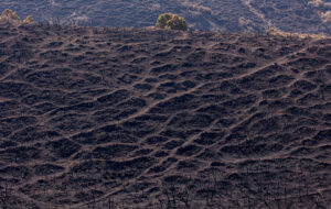
The Gold Mountain Fire left some hillsides naked, with the ground surface covered in ash. This area located along County Road 10 shows the burned-over soil, which authorities are concerned will be prone to mudslides and flooding if monsoonal precipitation arrives. These burned hillsides could impact several creek drainages, including Owl Creek, Nate Creek and Cow Creek. Erin McIntyre – Ouray County Plaindealer
But while large stretches along County Road 8 were scorched, much of the forest around the west side of Courthouse Mountain and Chimney Rock remained largely intact.
Below Owl Creek Pass, a Washington-based chainsaw crew with Swedberg Contracting was felling aspens and conifers Tuesday afternoon.
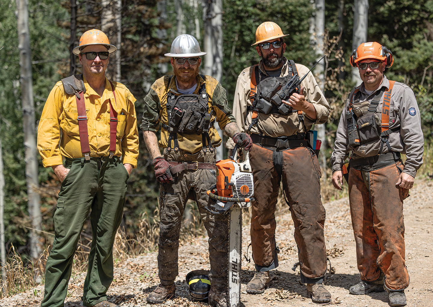
A tree-felling crew works off of County Road 8 on July 21, cutting down dangerous, burned trees threatening to fall on crews working below. These trees are sometimes called “widowmakers” for their deadly tendency to fall on people and injure or kill them. From left to right, pictured here are Dave Jones, Alan “Red” Mack, Wade Giguere and Randy Hemmah. Erin McIntyre – Ouray County Plaindealer
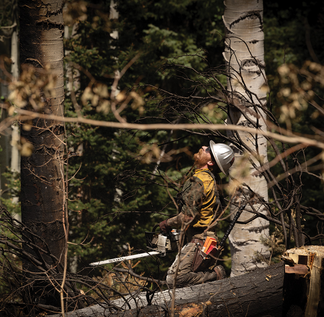
Alan “Red” Mack looks up to assess which way he should use his chainsaw to cut down a burned tree, just off of County Road 8 leading to Owl Creek Pass and Silver Jack Reservoir on July 21. The team of tree fellers went into the burned area to clear out dangerous, burned out trees that were unstable or snagged, threatening to fall on people re-entering the forest. Erin McIntyre – Ouray County Plaindealer
Alan “Red” Mack, in his ninth year working on timber crews responding to fires, made short work of torched trunks with three cuts from his saw, while the rest of his crew whooped as the trees crashed to the ground.
“You’ve got another widowmaker up there,” crew member Wade Giguere called down to Mack from the road, referring to the dangling limbs that can fall and kill or maim loggers.
A burned, cut-down tree is encircled in tape featuring an image of a skull and crossbones and labeled “killer tree.” A team of tree fellers focused Tuesday on clearing out trees compromised by the Gold Mountain Fire that could threaten to fall on people re-entering the forest. Erin McIntyre – Ouray County Plaindealer
With lines holding in Ouray County’s most populated areas along the Uncompahgre Valley, Smith – the incident commander – told the Plaindealer the hundreds of firefighters under his command are now largely using an indirect strategy of containment, working further from the flames to keep building their box.
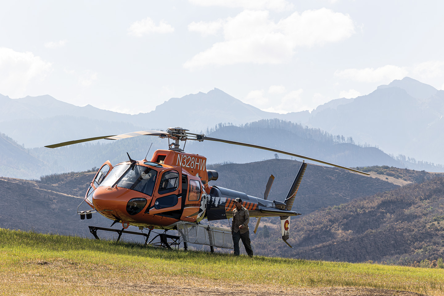
Helicopters continued to survey the Gold Mountain Fire area this week, like this one that landed at the J Bar M Ranch on July 21 east of Ridgway. While the initial attack on the fire included multiple aerial resources dropping water and fire retardant on the western side of the fire, above evacuated neighborhoods, those drops have decreased and the airplanes and helicopters performing those firefighting activities are now being used on different parts of the fire or on other fires. Erin McIntyre – Ouray County Plaindealer
“This is an area that hasn’t seen fire in hundreds of years,” Smith said. “And it’s in spruce and fir, which is a very challenging fuel type, because when fire gets into spruce and fir versus the pine varieties – the spotting distances, how many embers it throws up – is much higher than a lot of the other tree types out there.”
“So with this one, this is tough,” he added. “It’s in terrible terrain. It’s in spruce-fir, and we’re in an historic drought in an area that hasn’t seen fire.”
As monsoonal storms began rolling into the area last week, heavy winds largely blew the Gold Mountain Fire back on itself. But in neighboring Hinsdale County, the Elk Fire, which began on July 9 in even more remote and inaccessible country, rocketed from about 575 acres on July 14 to nearly 2,000 acres the following day. Officials were only able to determine that figure after a high-elevation infrared flight survey, and the fire sat at about 2,300 acres as of Wednesday morning. The Elk Fire remained at 0% containment.
A spokesperson for the Gold Mountain Fire team said aerial crews dropped retardant and water around the full perimeter of the Elk Fire when it began, all of which failed to stop its spread.
Most of the Gold Mountain Fire’s current activity is concentrated in its northeastern reaches, where firefighters continue to build fire lines along the East Fork of the Cimarron River. Meanwhile, in what’s been dubbed Division Zulu in the interior of the Uncompahgre Wilderness southeast of the Cimarrons, officials said Tuesday the fire’s spread had been halted by running into sheer rock.
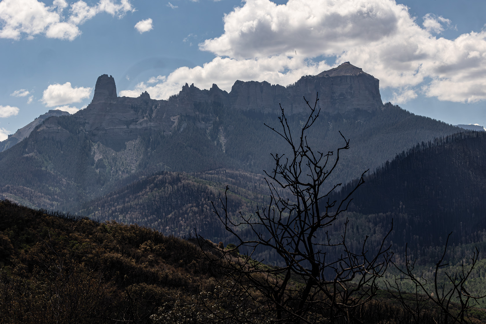
This photo taken from Vista Point on July 21 shows burned oakbrush in the foreground and the iconic Chimney Rock and Courthouse Mountain in the Cimarron Range. The fire burned up to Vista Point, and left patches of burned areas intermingled with foliage that didn’t burn in some spots. The area in front of the mountains is sometimes called Deb’s Meadow, where the original True Grit film featuring John Wayne used it as a film location. Erin McIntyre – Ouray County Plaindealer
Those natural buffers are a boon to firefighters, Smith said, given the limited options for containment thanks to rugged wilderness terrain miles from the nearest road.
“Out on the federal lands, fire is a cathartic component in the ecosystem,” Smith said. “We’re not saying we want fire, but if we can keep it on federal lands, let fire do what fire does, that reduces the impacts for the future.”
Chart Riggall is a journalist with Report for America, a nonprofit program that helps boost reporting resources in underserved areas. He’s also part of the Western Environmental Reporting Collaborative, a partnership Report for America has with High Country News and local news organizations across the West. Support his work with a tax-deductible donation here.