



A wildfire that started as a wisp of smoke on a cliffside just north of Ouray last weekend exploded to more than 15,000 acres by Wednesday, driven by winds north to the Cimarron Range east of Ridgway.
Just days after it started, the Gold Mountain Fire had raced up Baldy Mountain into the Cow Creek drainage and threatened to expand to Owl Creek Pass, forcing evacuations as far as Silver Jack Reservoir.
On its way, the fire surged into the cliffs above homes in Panoramic Heights and Ponderosa Village and threatened homes at Lake Lenore and stretched along County Road 14 on Gold Mountain.
The blaze, which ignited June 27 two miles north of Ouray, had not destroyed any homes. It did, however, burn through at least one cabin and at least one historic mining structure on Gold Mountain. It also destroyed a cell tower on the mountain, hampering cell service and the delivery of emergency alerts.
Authorities say the cause of the fire, which started on private land, is under investigation. The Ouray County Sheriff’s Office previously announced the fire started when a tree fell into a power line but later softened that statement and said it was under investigation by the U.S. Forest Service.
As of Wednesday morning, the fire continued to push north with the intense heat causing cauliflower-shaped pyrocumulus clouds to rise from the fire, obscuring the craggy peaks east of Ridgway.
This view of the Gold Mountain fire on Tuesday night shows the town of Ridgway in the foreground. The fire started north of Ouray on Saturday and quickly moved north to the Cow Creek drainage and beyond by Wednesday morning. Erin McIntyre – Ouray County Plaindealer
The fire showed no signs of slowing, fueled by a potent mixture of high winds, dry fuels and low humidity. There’s little relief in sight, with hot, dry and windy conditions expected to continue through at least Friday and the first chance of rain not appearing in the forecast until Tuesday.
Though some prayed for rain to bring relief, they also worried too much rain in a short period of time could result in more disaster — mudslides bringing down a slurry of ash and soil from hillsides no longer held in place by tree roots after the fire rendered their skeletons charred.
Local volunteer fire departments including Ouray, Ridgway and Log Hill, as well as firefighters who responded to help from neighboring agencies, built fire lines and kept the fire from destroying homes in the fire’s beginning days.
They were aided by aerial firefighting resources — helicopters and fixed-wing aircraft that dumped water harvested from Lake Lenore, Black Lake and Ridgway Reservoir on flames to protect homes.
Firefighting management transferred to a federal team on Monday night, the Rocky Mountain Complex Incident Management Team 3, which established operations at the Ouray County Fairgrounds.
Casey Cheesebrough, the incident commander for the fire, told community members at a public meeting Tuesday night the combination of unfavorable weather, dense forests and rugged terrain will make containing the fire a marathon, not a sprint.
“It is going to be a long haul,” he told attendees of the standing-room only meeting at Ridgway Elementary School.
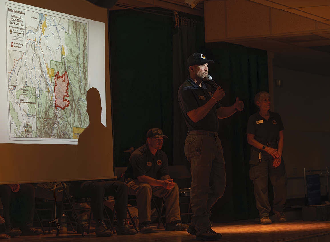
Evacuees who had to leave their homes since the fire started asked officials when they could return home but did not receive answers by Wednesday morning. It was unclear how many people were evacuated. Red Cross officials said they had assisted four people at the shelter established at Ridgway Secondary School. Some evacuees were staying with friends or relatives, and others stayed in hotels in Montrose.
Forest closed, evacuation area expands
The fire jumped the Cow Creek drainage Tuesday afternoon, triggering new evacuations between County Road 8 and County Road 8A and areas east of the junction of County Road 12 and County Road 12A. Wind gusts of up to 35 mph carried embers a half-mile ahead of the main fire front.
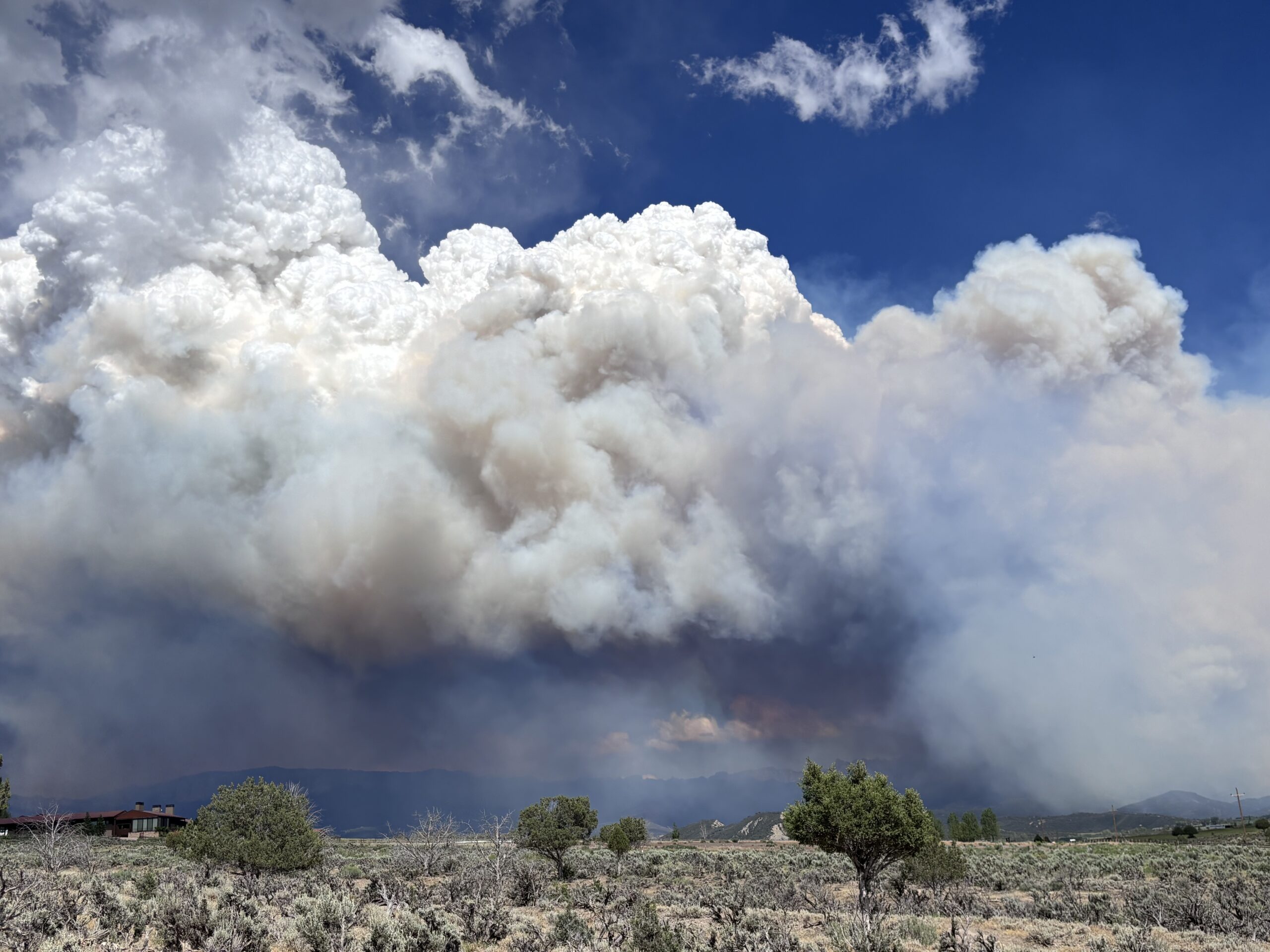
The Cimarrons were obscured by smoke and clouds from the fire spreading north on Tuesday afternoon. This photo was taken from the RAT Trails parking lot off County Road 10, just east of Second Chance Humane Society’s shelter Erin McIntyre – Ouray County Plaindealer
Second Chance Humane Society closed its shelter on County Road 10 and evacuated the animals on Wednesday morning, citing poor air quality, losing water service to the shelter and clinic and increased concern about the rising flames in the distance. The animals have been transferred to a shelter in Delta or temporarily relocated to foster homes.
The fire made a significant run up Stealey Mountain and churned toward Owl Creek Pass, prompting the U.S.
Forest Service to take the extraordinary step of closing a wide swath of the Uncompahgre National Forest on Tuesday.
Ouray County alpine rangers and Forest Service staff rushed to set up road barricades and evacuate campers.
The forest closure area on Wednesday morning included land in Ouray, Gunnison and Hinsdale counties east of U.S. Highway 550, south of U.S. Highway 50, west of Pinnacle Ridge, north of Matterhorn Peak and northeast of Cascade and Bridalveil creeks. The closure restricts public access to all lands, roads and trails, including Silver Jack Campground and boat ramp, Big Cimarron Campground and Beaver Lake Campground.
Dana Gardunio, Ouray district ranger for the Grand Mesa, Uncompahgre and Gunnison National Forests, told the Plaindealer that Forest Service officials closed the forest earlier than planned to try to ward off a surge of people heading into the backcountry for the holiday weekend. She said staff extinguished several campfires that campers left behind in their hurry to leave, despite the fact that campfires outside of permanent pits or grates were banned at the time.
The Grand Mesa, Uncompahgre and Gunnison national forests moved into stage 2 fire restrictions Wednesday, meaning no fires of any kind are allowed, except for devices fueled by liquid or gas that can be turned off and on. Ouray County, the city of Ouray and the town of Ridgway have also adopted stage 2 restrictions.
Evacuations remain in place for the County Road 14 corridor, including the Panoramic Heights and Lake Lenore neighborhoods, as well as the area from Red Stone Road north to Cedar Hill Cemetery east of U.S. 550. Pre-evacuation notices are still in effect for several neighborhoods west of U.S. Highway 550 between Ouray and Ridgway. Authorities have allowed some homeowners to briefly return with an escort to grab essential items, but there’s no indication yet when evacuation orders will be lifted.
A two-mile stretch of U.S. 550 north of Ouray that had been closed since Saturday night reopened Wednesday afternoon.
Fire management shifts
More than 220 firefighters are now battling the blaze, according to InciWeb, nearly double the number before the incident management team came on board Monday. The management team took over the Ouray County 4-H Center and Fairgrounds with dozens of vehicles, tents and operational equipment.
Cheesebrough credited local and regional firefighters for the initial attack on the fire.
“They did a tremendous job. Most of the success to this point was on the backs of your local responders,” he said, prompting a round of applause from the crowd at Tuesday night’s meeting.
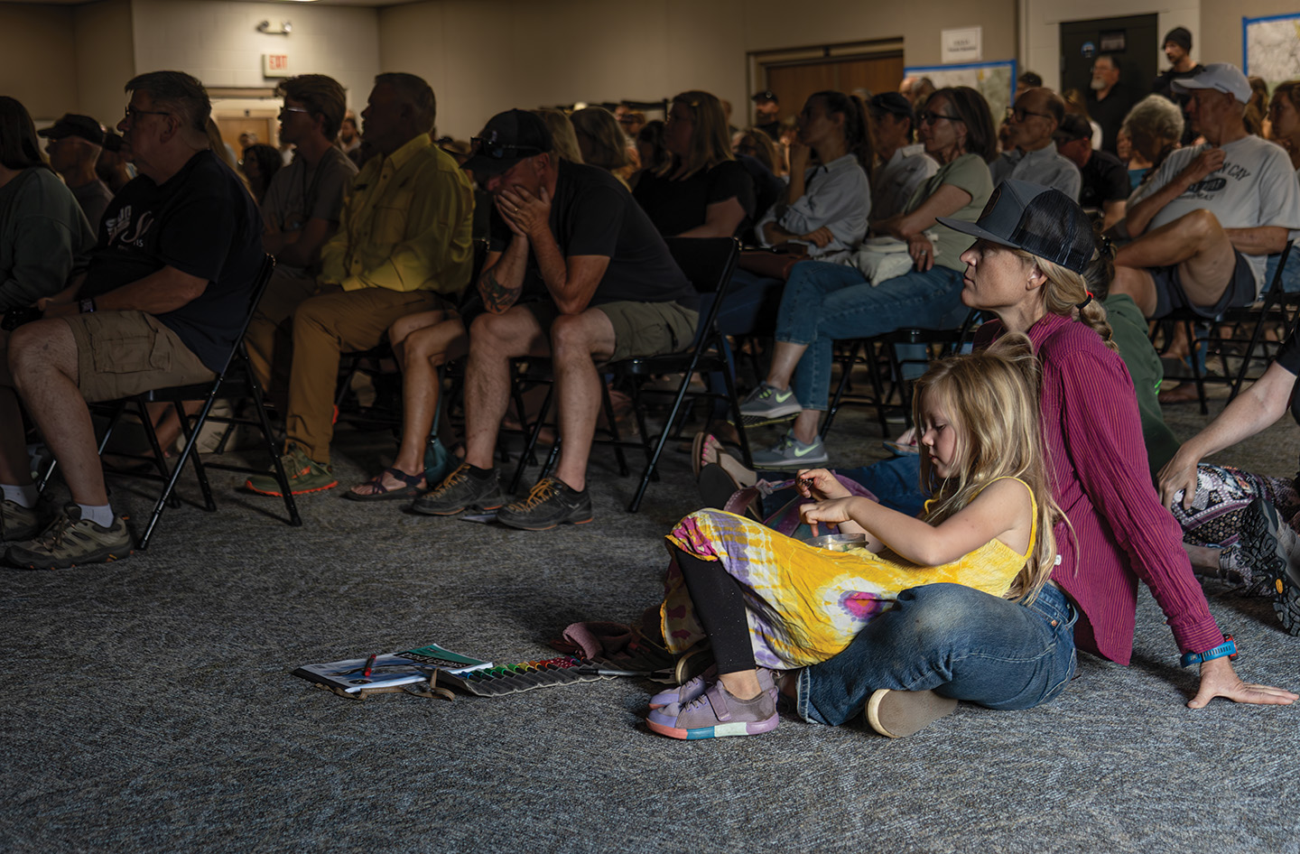
The crowd listens as fire managers describe the tinder-dry conditions and weather forecast for the Gold Mountain Fire. There is a slight chance of rain on Monday, according to the National Weather Service, and the region remains under a red flag warning. Erin McIntyre – Ouray County Plaindealer
Strategy and challenges
Tyler Nathe, operations section chief with the incident management team, said the top priority in fighting any fire is always firefighter and public safety. Fire managers identify resources at risk and work to protect them. In the case of the Gold Mountain Fire, that includes the city of Ouray, U.S. Highway 550 and homes and important infrastructure in the area.
Cheesebrough said the situation closer to Ouray looks much better now than it did a few days ago. The fire around Lake Lenore isn’t extinguished but has significantly reduced in intensity. Crews continue to secure firelines and put out hot spots in that area to protect homes.
But the circumstances remain daunting for several reasons.
The fire is moving too quickly for a sustained, direct attack. That means firefighters are scouting areas ahead of the blaze, removing fuel and conducting strategic firing operations, Nathe said. In these situations, fire managers must consider everything from fire behavior to topography and weather, in addition to resources.
The fire is burning in steep, rugged, often inaccessible terrain. Placing firefighters in that kind of environment isn’t worth the risk, Nathe said.
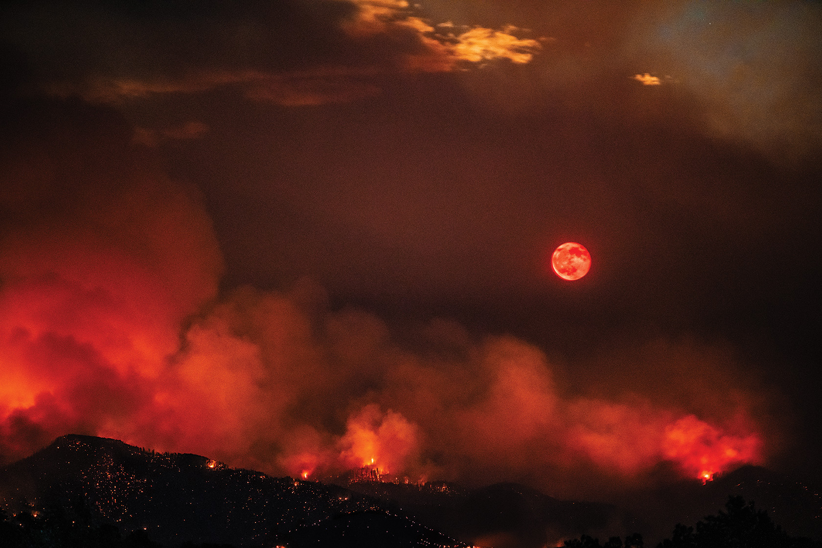
The Gold Mountain Fire lights up the night and the Cimarrons east of Ridgway under a bright moon on Tuesday night. Photo courtesy Meg ONeill/runwildwithmephotography.com
Fire managers have access to aerial assets like fixedwing aircraft and helicopters to drop slurry and water, but gusty winds and low visibility from the smoke have restricted their usage.
“The winds we’ve had the last couple of days have limited severely our ability” to ensure the safety of pilots and firefighters, Cheesebrough said.
The incident management team is also competing for limited resources, as other fires have ignited and spread across Colorado. Three federal wildland firefighters died last weekend when they were overrun while fighting the Snyder Fire west of Grand Junction. Other fires near Pueblo and Leadville have spread quickly and required immediate assistance.
“It got busy very quickly, so the resources that were around … they got sucked up pretty quickly with all that fire activity,” Cheesebrough said.